
-
توجه: در صورتی که از کاربران قدیمی ایران انجمن هستید و امکان ورود به سایت را ندارید، میتوانید با آیدی altin_admin@ در تلگرام تماس حاصل نمایید.
You are using an out of date browser. It may not display this or other websites correctly.
You should upgrade or use an alternative browser.
You should upgrade or use an alternative browser.
تجزیه و تحلیل وضعیت جوی در سال زراعی 93-94 /فصل دوم( دي- بهمن-اسفند)
- شروع کننده موضوع heaven1
- تاریخ شروع
- وضعیت
- موضوع بسته شده است.
ali_kermanshah
کاربر ويژه
وقتی upper level low تضعیف بشه اون کم فشار دینامیکی جلوش هم خودبخود کم اثر میشه دیگه ولی آپدیتهای هر 6 ساعت یکبار سایتeumetrainمخصوص رصد دقیق رفتار این سامانه است فراموش نکنید.
دیگه هیچ وقت این اسم upper level low یادم نمیره ...
ali_kermanshah
کاربر ويژه
| UPPER LEVEL LOWS |
METEOROLOGIST JEFF HABY
Upper level lows are important to forecasting and can dramatically alter one's forecast. Upper level lows can occur in association with a mid-latitude cyclone or may begin without the aid of a mid-latitude cyclone. Upper level lows without the aid of a surface low can develop when air flows over a mountain range, in association with an upper level short wave, or in association with a jet streak.
When analyzing a strong mid-latitude cyclone, some common patterns can be noticed. One is that the trough associated with a mid-latitude cyclone tilts toward the cold air (generally tilts to the northwest with height). Therefore, the upper level low pressure (trough) in association with a mid-latitude cyclone may be several 100 kilometers displaced from the surface low toward the west or northwest. Since the forecast models have a more difficult time initializing an upper level low than a surface low, upper level lows can result in a busted forecast. The forecast models have a better vertical resolution of the low levels of the troposphere as compared to the upper levels. In some mid-latitude cyclones, the tilt of the mid-latitude cyclone will be enough to allow the upper level low to displace from the surface low.
What causes an upper level low? An upper level low is a region of positive vorticity. This positive vorticity can be caused by counterclockwise curvature around the upper level trough and counterclockwise shear associated with the speed shear of a jet streak. The circulation around an upper level low can build to the surface over time. In these cases, two areas of low pressure will be noticed on the surface chart. These are sometimes referred to as double-barrel low-pressure systems. Upper level lows can also decrease in intensity through time.
A huge forecasting problem is determining whether an upper level low will strengthen or weaken with time. When nowcasting, they are best viewed on satellite imagery. Image by image they should be monitored for intensity. When the clouds brighten (become whiter) in association with the upper level low, that is an indication the upper level low is strengthening.
If an upper level low does show on the analysis or forecast models it is best seen at the 500 millibar level or 700 millibar level. Upper level lows have been responsible for bringing unexpected heavy snows in the winter. The spin-up of vorticity in an upper level low causes the air to rise and cool. Since the upper level low is tilted over the cold air, cold surface temperatures and upper level lifting combine to produce wintry precipitation well behind (to the west or northwest) or the surface cold front. When a mid-latitude cyclone begins to mature, watch for the development of the upper level low.
آخرین ویرایش:
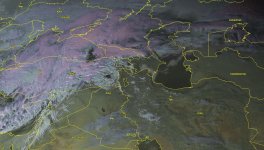
سال 86 قبل از ورود سیستم به ایران
امسال قبل ورود سیستم به ایران
سرمای شرقی و موندگار سیبری کجا و سرمای پیزوری این سیستم کجا
مشخصه که در 86 و هر زمستان سردی سرمای سیبری در کاره
Amir Mohsen
متخصص بخش هواشناسی
یک سوال داشتم .
نقشه های سال 86 رو زیر نظر داشتی ؟
من اون سال با این نقشه ها اشنا نبودم و هواشناسی تلویزیون رو نگاه می کردم .اون سال همچین پیشبینی نکرده بود. فقط سرما و بارش پراکنده . یادمه همون سال همه از سازمان انتقاد می کردن که چرا درست پیشبینی نکرده . امکان داه مثل اون سال بشه ؟
مقایسه ژانویه 3 سال با هم :
2005
neutral Ao
pna-
wpo-
NAo+
epo-
2008
neutral pna
AO+
NAO+
WPO+
EPO+
2015
Amir Mohsen
متخصص بخش هواشناسی
سال 86 قبل از ورود سیستم به ایران
امسال قبل ورود سیستم به ایران
سال 2005 مثل امروز:
امروز بعد از ظهر:
ali_kermanshah
کاربر ويژه
ali_kermanshah
کاربر ويژه

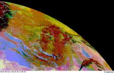
The dominant weather pattern across Europe this winter has featured storms tracking across the south from Italy into the Balkans before crossing the Black Sea with impacts in Turkey and neighboring areas.The first full week of 2015 will not be any different as yet another winter storm will move northeastward from Turkey and into southern Russia and Geor
The storm took shape from Monday into Tuesday. At the same time, cold air from northern Europe drained into the strengthening storm system causing snow to break out across western Turkey.
Much like other portions of the world, Turkey will experience two interesting meteorological phenomena that will contribute to heavy snow of 15-30 cm (6-12 inches) in the mountains and along the coast of the Black Sea.Strong north winds will cause winds to travel up the Pontic Mountains (which is called upslope flow) that will enhance snowfall rates along the north slopes.Not only will the upslope flow create heavy snow, these north winds will be traveling over the Black Sea and will pick up its moisture and deposit it in the vicinity of this sea. Immediate coastal regions will be a bit too warm to experience heavy snow, but higher elevations just inland will experience significant travel disruptions.Even far removed from the center of the storm, flow off the Black Sea resulted in snow showers around Istanbul where a fresh coating of white covered the city for a time on Tuesday.
Ankara, the capital city of Turkey, experienced gusty winds and snow squalls Monday night into Tuesday. Snow averaged 5-10 cm (2-4 inches) with locally higher amounts around the city. Additional snow is expected through Wednesday morning.RELATED:
Turkey Satellite Page
Ankara, Turkey, Forecast
Istanbul, Turkey, ForecastWhile on the cold side of the storm the major issue will be heavy snow, heavy rain will fall to the south and east. Southeastern Turkey, Lebanon and Israel are some regions that will experience the mild and wet side of this storm.Heavy rain could lead to flooding problems from Tel Aviv northward through Beirut, Tripoli and Latakia. Rainfall amounts of 25-75 mm (1-3 inches) will be common through Wednesday.While much of the precipitation will fall as rain, colder air will rush into the region Tuesday night and Wednesday causing rain to mix with and change to snow in the higher elevations, mainly above 600 meters (2,000 feet).Yet another concern is blowing dust which will cause low visibility from parts of Egypt into Jordan and Saudi Arabia. Wind gusts of 50-65 kph (30-40 mph) will be common with isolated gusts to around 80 kph (50 mph). Wind gusts of this magnitude can result in blowing dust and dust storms that result in visibility in under 0.5 of a kilometer (0.3 of a mile) and causing dangerous travel.Meteorologist Mark Paquette contributed to this story.
آخرین ویرایش:
seyyedalireza
مدیر موقت
من میگم که اگه خدا بخواد بارش خيلي خوبی داریم من خودم لحظه ای از بارش رو دوست دارم که بارون تبدیل به برف میشه واقعا لحظه جذابیه که انشالله جمعه اين صحنه رو خواهم دید
seyyedalireza
مدیر موقت
االان دو سه روزه که ترم افزار وان ودر بارش خ.بی رو برای ما متصور هستش
- وضعیت
- موضوع بسته شده است.