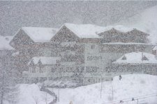
باز هم همزمانی رخداد بارش برف:
[h=2]More Than 110 Million Brace for Weekend Snowstorm
[h=6]By
Alex Sosnowski, Expert Senior Meteorologist [h=5]December 14, 2013; 5:25 AM
Share |
The storm is discussed in this expert video.
Heavy snow and travel disruptions will spread from St. Louis and Pittsburgh to Philadelphia, New York City and Boston on Saturday.
The snowstorm will span more than 1,000 miles.
Thanks to recent Arctic air making roads and sidewalks much colder compared to previous storms, enough snow to shovel and plow is in store from parts of Missouri, Illinois, Indiana, West Virginia, Virginia, Maryland and New Jersey to much of Ohio, Pennsylvania, New York,
Massachusetts, Connecticut, Rhode Island, Vermont, New Hampshire and Maine.
@Leadership_One tweeted: "Snowstorm to Impact More Than 1,000 Miles From St. Louis to Boston. Looks like Old Man Winter is showing up early" Additional Relevant Tweets and Social Media Reaction
Not only will the storm make roads and sidewalks slippery, raising the risk for slip-and-fall incidents and auto accidents, but it is likely to cause many flight delays and cancellations. The visibility will be poor, runways will become snow covered and aircraft will need to be de-iced.
Snow will fall on and impact every major city and rural area from St. Louis to Boston, including Chicago, Detroit, Cincinnati, Cleveland, Pittsburgh, Philadelphia and New York City. The area encompasses about 110 million people.
The storm will move from the Midwest to the Northeast during the course of Saturday and Saturday night.
A mixture of snow, sleet and rain will mitigate accumulations across central Missouri and eastward along the Ohio River. However, enough wintry mix will fall to make roads slippery.
Long stretches of the I-70, I-75, I-80 and I-90 corridors may be snow covered in the Midwest.
RELATED:
Who Has the Best Chance for a White Christmas?
You've Never Seen a Snowflake in This Much Detail
Winter Weather Center
A quick change to plain rain is likely from Roanoke, Va., to Washington, D.C., and Baltimore with little or no accumulation to up to an inch or so. Some roads may be slippery.
However, farther northeast along the I-95 corridor, the change to rain following snow and/or a wintry mix will take longer, leading to several inches accumulation and more widespread slippery travel.
Snow and a wintry mix are likely to impact play during the Army-Navy Classic on Saturday afternoon and evening at Lincoln Financial Field in Philadelphia. This wintry game will occur just less than a week after heavy snow fell during the Eagles-Lions game. Snow buried the field and had players sliding and shoveling snow with their feet during last Sunday's game.
Farther north over the Midwest and into western and northern
Pennsylvania to western New York, where the cold air hangs on longer or lingers through the duration of the storm, heavy snow will fall with some communities receiving 6 inches of snow. Roads will be slushy to snow covered over much of the I-80, I-81, I-87, I-88, I-90 and I-95 corridors.
A general swath of 6- to 12-inch snowfall is likely to reach from part of central Pennsylvania through the Pocono and Catskill mountains and into much of the Hudson Valley of New York, northern Connecticut, central and western Massachusetts, Vermont, New Hampshire and Maine. However, some locations from upstate New York into northern New England can have more than 12 inches from this storm.
In much of New England, the storm will linger into Sunday with ongoing travel disruptions. While flurries will occur over the central and southern Appalachians and downwind of the Great Lakes over the Midwest, the storm will be over across the Ohio Valley and coastal mid-Atlantic, and travel conditions will improve.
Areas made wet and slushy from melting during the day on Sunday will freeze on Sunday night, producing patches of black ice.










 :34: به بابام میگم بندازه بعد میذارم انجمن:81: