امیر این که افتضاحههههه :|

You are using an out of date browser. It may not display this or other websites correctly.
You should upgrade or use an alternative browser.
You should upgrade or use an alternative browser.
مباحث عمومی هواشناسی
- شروع کننده موضوع Amir Mohsen
- تاریخ شروع
- وضعیت
- موضوع بسته شده است.
Amir Mohsen
متخصص بخش هواشناسی
Amir Mohsen
متخصص بخش هواشناسی
امیر این که افتضاحههههه :|
بله افتضاح بدجور...
محمدرضا ...
New member
http://m.yr.no/sadji/Iran/Razavi_Khorasan/Mashhad/guhkesáiggediedáhus.html برا داخل شهر قابل تحمل تره
Amir Mohsen
متخصص بخش هواشناسی
Last night’s ECMWF model weekly run is virtually unchanged from its previous run. The figures below can be compared with those in a blow posted on the 7th March. Strong high pressure over Europe with above normal temperatures, well below normal precipitation, mostly gentle winds and clear sky will give way to a NW to WNW air flow from the Atlantic into western and central Europe with wetter weather and temperature anomalies lowering to around normal to slightly below normal, as well as windier across NW Europe.
Over Eastern and south-eastern Europe and east to Turkey the models agree that temperatures are going to be well above normal to nearer normal over the south-east and Turkey during weeks 3 and 4 and mostly around normal precipitation.
Over Eastern and south-eastern Europe and east to Turkey the models agree that temperatures are going to be well above normal to nearer normal over the south-east and Turkey during weeks 3 and 4 and mostly around normal precipitation.
محمدرضا ...
New member
بله افتضاح بدجور...
نظرم در مجموع نسبت به صبح خیلی تفاوت نداشته واسه مشهد
Amir Mohsen
متخصص بخش هواشناسی
Chinese Students Pray for Passengers on Missing Jet

Amir Mohsen
متخصص بخش هواشناسی
این جماعت قرار هست در روزهای آینده ، لحظات پر بارش و پر خاطره ای رو تجربه کنند!!!!!!!!!!!!!!!!!!


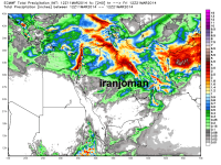
این که واسه مشهد خیلی خوب نشون میده :|نامردا سعی کردن مودمم رو هک کنند!!!
شرمنده که آپدیت ecm رو دیر میزارم!!! داشتم با مودم ور میرفتم حالا بیان هک کنن بابای آمریکا هم نمیتونه
آپدیت ecmwf تا 240 ساعت آینده
مشاهده پیوست 54282
این که واسه مشهد خیلی خوب نشون میده :|
خوب بیشتر بارش ما هفته بعد هست که خدا میدونه محقق میشه یا نه
اهووم پس محقق نمیشه.چون دو روز قبل از موعود یا باد میبرشون یا بلاک میشن و در نهایت میرن افغانستان
خوب بیشتر بارش ما هفته بعد هست که خدا میدونه محقق میشه یا نه
 (((
Amir Mohsen
متخصص بخش هواشناسی
آخرین تصویر ماهواره ای + مولتی سنسور بارش:
Amir Mohsen
متخصص بخش هواشناسی
در واقعیت هواشناسی همه چیز امکان داره خصوصا بارشهای غیر مترقبه و در شمال غربی ترین نقطه خراسان رضوی در حالیکه بارشی پیش بینی نشده بوده ، بارش قابلی ظرف 3 ساعته گذشته بوقوع پیوسته:
نامردا سعی کردن مودمم رو هک کنند!!!
شرمنده که آپدیت ecm رو دیر میزارم!!! داشتم با مودم ور میرفتم حالا بیان هک کنن بابای آمریکا هم نمیتونه
آپدیت ecmwf تا 240 ساعت آینده
مشاهده پیوست 54282
هر ماه باید رمز مودم رو تغییر بدی .
برای من هم شده بود
Amir Mohsen
متخصص بخش هواشناسی
شب دوستان عزیز خوش تا بعد............

- وضعیت
- موضوع بسته شده است.